
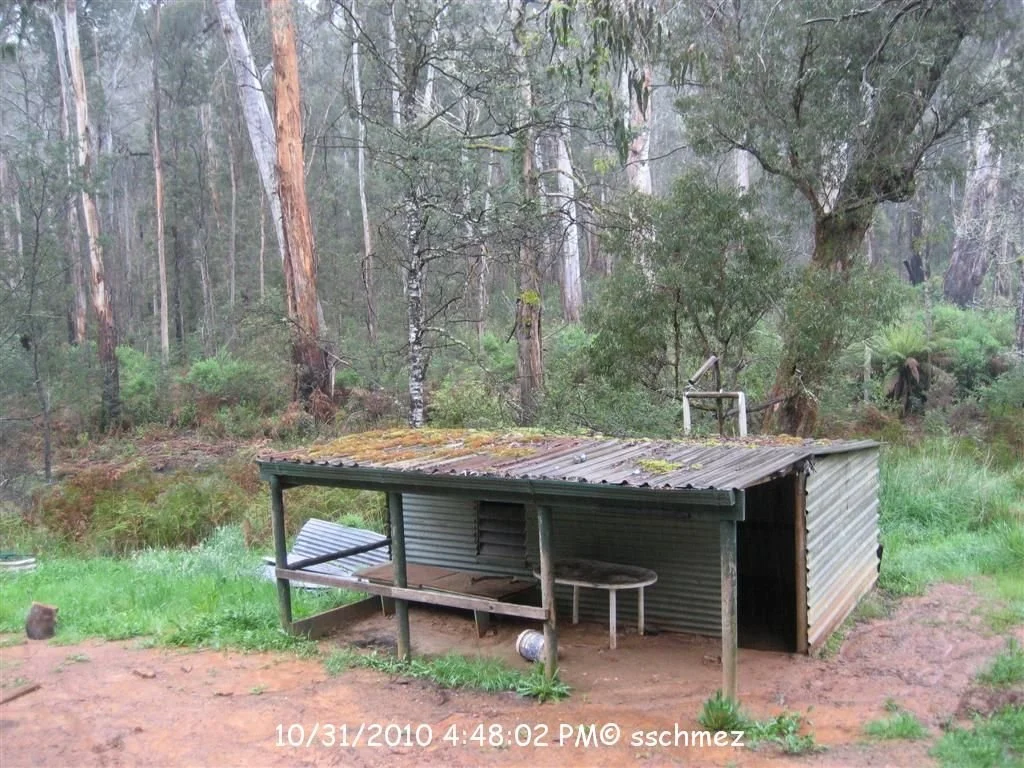
Silverwater Hut
Photograph courtesy of Steve Schmezle, dated 31 October 2010 in the image.
Located at South of Wrens Flat, on the Jamieson River South Branch Track.
From Jamieson, follow Jamieson–Licola Road towards Mount Skene, then the Mount Sunday Road approach to Wrens Flat. Published campground directions give about 29 km to the Mount Sunday turn-off and another 13 km to Wrens Flat, approximately 42 km in total. This is a remote, largely gravel 4WD approach; conditions and seasonal gates must be checked.
The mapped hut is about 1.7 km south of Wrens Flat in a straight line. The precise South Branch Track junction, requires confirmation. River crossings may limit access.
History and construction
The photograph shows a small corrugated-iron shelter with a low roof, open verandah, bench and table. Its builder, construction date and original purpose are not yet documented here.
ExplorOz labels the site “ruin?”. this is not a confirmed condition report, but a recent photograph or inspection is needed before describing the hut as currently usable.
Caretakers
Earlier records list DELWP as land manager.
References
VHCHA, Silverwater Hut and mapped location;
ExplorOz, Silverwater Hut;
Wrens Flat campground access directions.
Mapping Guidance
GPS: approximately 37.35724°S, 146.38055°E.
UTM Zone 55H: 445142 m E, 5865317 m N.
Approximate VHCHA position, corroborated within about 25 m by ExplorOz, treated as WGS84; not field-verified. This replaces the earlier profile position about 440 m south-east.