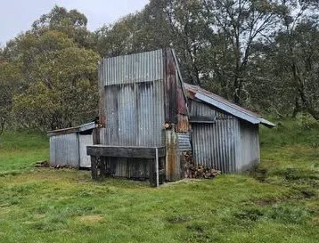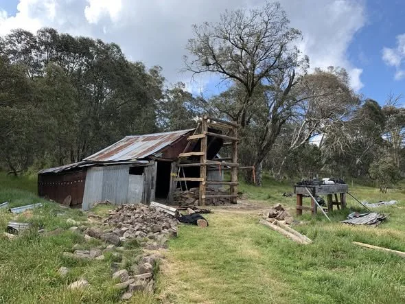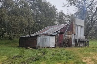
Kellys Hut @ Holmes Plain
Photo courtesy of the VHCHA - original hut not the 2025 restoration.
Known as Kellys Hut or Kelly Hut, Holmes Plain. This is a separate hut from Kellys Hut at Marum Point on the Bogong High Plains.
Located on Kelly Lane at Holmes Plain.
A practical driving approach starts at Arbuckle Junction, about 46 km from Licola via Tamboritha Road. The first approximately 22 km is sealed, followed by gravel suitable for 2WD in good dry conditions when open.
Park clear of the junction and follow McMillans Walking Track west over Arbuckle Plain, then descend to Shaw Creek and cross towards Holmes Plain. Allow about 4 km each way (8 km return), with an initial climb, creek crossing and some indistinct sections.
A suitable 4WD may approach closer along Kelly Lane when open; check seasonal gates and current track access rather than assuming the southern Thomastown bridge is usable.
History
The hut was built in 1934 for James (Jimmy) Kelly (1892–1954), one of 17 siblings. His father Pat selected Gippsland land around 1872. Jimmy returned from First World War service and took up a soldier-settlement offer.
The Kelly, Higgins and Holmes families came from Talbotville, where they bred horses for the Indian market. Constantine and James Holmes brought cattle from their Eaglevale run to these plains between about 1869 and 1913. Their earlier hut stood nearby.
Jimmy obtained the grazing lease in 1920. With the Holmes hut already ruined, he shared Higgins Hut until it burnt in 1933. In 1934 Connelly and Howlett built this hut, using slab-fence rails and supplies brought by packhorse by Jimmy Kelly and Kevin Higgins. Jimmy later spent much of each year here with his cattle. He never married and died in 1954, aged 61. The existing account records restoration as completed in December 2025.
Construction
Timber rails and corrugated iron.
Caretakers: Parks Victoria and the Victorian High Country Huts Association.
References
Hueneke;
G. Butler (1996);
Magnussen;
Stephenson;
Bushwalking Victoria, Arbuckle to Kellys Hut;
VHCHA hut map.
Mapping Guide:
GPS: 37.41200°S, 146.75239°E.
UTM Zone 55H: 478088 m E, 5859393 m N. Approximate VHCHA latitude/longitude, treated as WGS84 for conversion. The separate published grid reference differs by about 210 m.