
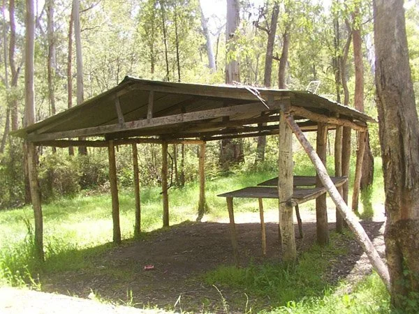
Humffray River Shelter
Known as Humffray Shelter or Humffray River Shelter Hut.
Located at Humffray River Track, east of Wonnangatta Valley in the Alpine National Park, at approximately 500 metres elevation.
The shelter is beside the remote 4WD track following the Humffray River, approximately 4 km upstream from its lower approach near Wonnangatta Track. Access involves repeated river crossings.
A recognised approach from Dargo follows Wonnangatta Road to Eaglevale, then Eaglevale Track and Wombat Range Track towards the Humffray River. Follow Humffray River Track upstream towards the mapped shelter position. The mountain tracks require a capable high-clearance 4WD, with low range needed on steep sections. There is no established nearby 2WD parking point offering a short walk to the shelter.
Access update — November 2026
Parks Victoria lists Humffray River Track between Hart Spur Track and Water Spur Track as closed because of a significant landslide. The mapped shelter lies within this section. Confirm reopening before planning a visit; access to Wonnangatta Station remaining open does not establish access to the shelter.
Brief History
Humffray River Shelter is a basic open shelter in the forested Humffray River valley. A published touring account attributes its origins to use by cattle drovers and records later use by deer hunters. Its builder and construction date remain unconfirmed.
A four-wheel-driving club recorded stopping at the shelter in February 2016, confirming its existence at that time.
Construction
An open-sided bush shelter. Further construction details should be checked against photographs of the building.
References
ExplorOz, Humffray River Shelter, Place ID 244611 — mapped location.
Trayon Campers, Wonnangatta Camping / Wonnangatta Guide — Humffray River Track and shelter description.
Offpeak 4WD Club, High Country — February 2016 — recorded visit to the shelter.
Hema Maps, Hema’s Top 5 Victorian High Country 4x4 Drives — Dargo–Eaglevale–Wombat Range approach.
Parks Victoria, Change of Conditions — Humffray River Track landslide closure.
Mapping Guidance;
GPS: 37.20593°S, 146.90515°E.
UTM: Zone 55H, 491583 m E, 5882278 m N. Approximate mapped shelter position; not field-verified.