
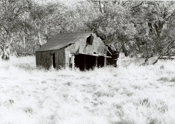
Chester's Hut Site
Known as Chester’s Hut or Chester’s Yards Hut. This profile concerns the Tamboritha hut, not the Mountain Ash Top Hut farther west.
Located about 1 km west of Tamboritha Road near Tamboritha Saddle, on the plateau above Licola.
From Licola follow Tamboritha Road towards Bennison Plains and the saddle; the first approximately 22 km is sealed, followed by gravel. The final hut approach crosses land listed by VHCHA as private: obtain permission and current entrance, gate and parking directions before leaving the public road. The earlier account gives about 1 km from the road, but the precise walking route and total driving distance remain unverified.
History
Built about 1923. Norm Chester took over the lease in 1954. Earlier descriptions report fire and cattle damage; ExplorOz now lists it as a ruin. Its present condition and any fire dates need confirmation. Higgins Hut is a separate nearby hut.
Construction
Walls and roof of flattened iron containers, probably kerosene tins, supported by timber posts. Earlier accounts describe deteriorating corner posts.
Caretakers: none identified.
References
Hueneke, pp. 33, 233; S
tephenson (1980);
Siseman, p. 85;
Kevin Higgins, personal communication;
VHCHA hut list (private land);
ExplorOz, Ruin: Chesters hut (1923), PlaceID 247547.
Mapping Guidance:
GPS: 37.46815°S, 146.70888°E.
UTM Zone 55H: 474257 m E, 5853152 m N. Approximate ExplorOz ruin position, treated as WGS84. The former coordinates near 37.365°S, 146.491°E referred to a different western locality.