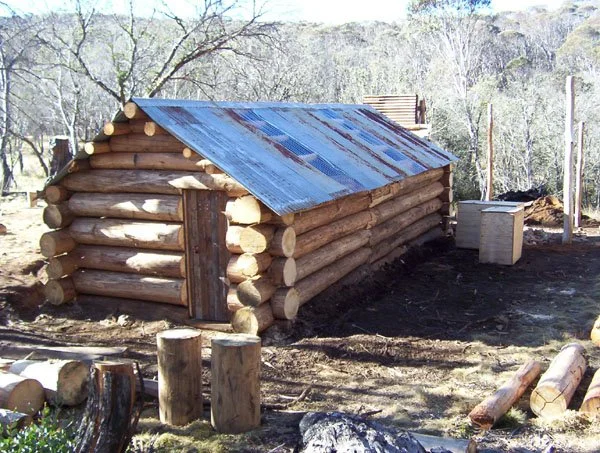
McNamara’s Hut, Buckety Plain
Known as: McNamara Hut. Also known as Macks Hut or Roney Macs Hut.
Located about 2–3 km off the Bogong High Plains Road at Buckety Plain.
From Falls Creek follow the sealed High Plains Road towards Omeo and take the signed McNamaras hut/fire-trail turn-off, described in the earlier account as about 1.5 km east of the Buckety Plain cattle grid. The final unsealed access needs a suitable 4WD and current road advice.
The earlier account records a locked gate about 300 m before the hut: if that remains the permitted parking point, walk approximately 300 m each way. If the access track is closed or unsuitable, park legally at the road and allow about 2–3 km each way instead. Confirm gates and seasonal closures before visiting. This is the Buckety Plain hut, not McNamaras Dinner Plain Hut on Youngs Track.
Brief History
The original was built for grazing and extended twice for horse tours, by Roney McNamara, Mick McNamara and Bill Toland in the 1940's.
The hut was largely rebuilt by Scouts in 1974, with further modifications being made by the Mittagundi Outdoor Education Centre in 1980 and to the wood store in the 1990s.
The hut was no longer used for grazing, but falls within the HG Faithfull Estate, managed by Mrs Sykes. Cattle were on-site in January 2002 during the visit, when the photograph on the previous page, was taken.
The original hut was destroyed in the 2003 fires. VHCHA rebuilt it in April 2004. The previous location paragraph’s “2024” date was a typographical error.
Construction
Log cabin, wooden floors (some dirt) with an iron roof. The flooring is butted 140 mm hardwood, and refurbishment with 190mm hardwood. Logs are chocked; the earlier condition description predates current inspection and should not be read as a present-day assessment.
There are a number of elevated sleeping platforms for quite a number of people.
Caretakers - Mittagundi Outdoor Centre
References
Hueneke Pp159, 240.
Butler 1996, Pp192 - 196.
Magnussen Pp126 - 127.
Mapping Guidance
GPS: approximately 36.95499°S, 147.33393°E.
UTM Zone 55H: 529729 m E, 5910069 m N (WGS84). Approximate VHCHA mapped position.