
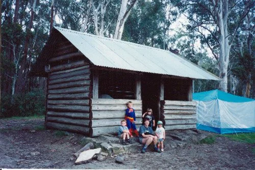
Cobbler Lake Shelter
Known as Cobbler Lake Hut
Photograph: 1992 by Olaf Moon and family.
Located at Lake Cobbler. From Whitfield, drive south through Cheshunt and follow Upper Rose River Road, then Lake Cobbler Road via Bennies, about 47–48 km in total. The final gravel road is rough; high-clearance 4WD is recommended beyond Bennies. Some guides allow high-clearance 2WD in dry conditions, but check current road conditions and seasonal gates. Park at the lakeside camping area and walk the short distance to the shelter; the final walking distance is less than 1 kilometre.
History
Lake Cobbler was created in the 1960s by damming a swamp in the Dandongadale headwaters. An early log-and-bark hut may have been built by the Lovick family. Sam Christopher and Frank Gorman, grazing leaseholders from 1929 into the 1940s, built a later paling hut. Both stood together for a time. A third hut was moved here by dozer for the South Wangaratta mill in the 1970s.
The present profile records July 1988 for the Wangaratta 4WD Club shelter. Regional tourism sources instead give 1986; confirm the date against club records.
Caretakers – Wangaratta 4WD Club
References
Victorian parks service, earlier profile attribution.
Visit Wangaratta, Lake Cobbler.
Victoria’s High Country, Mount Cobbler.
Mapping Guide
GPS: approximately 37.04949°S, 146.62622°E.
UTM Zone 55H: 466764 m E, 5899572 m N. WGS84 assumed; approximate position, not field-verified.