
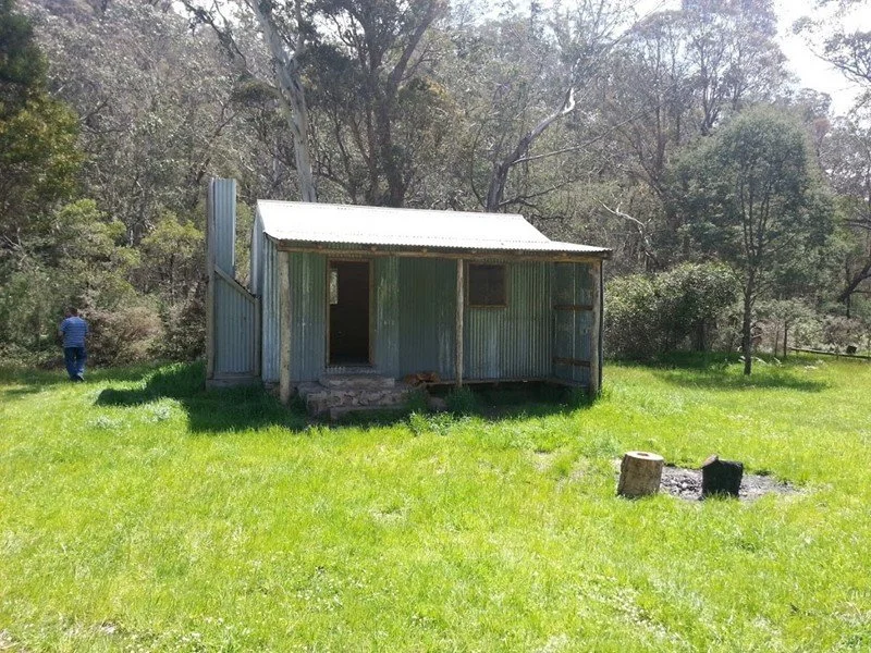
King River Hut
Photo by Ian Hunter 2012. Others below by Ian plus Bill Statton.
Known as King Hut or King River Hut.
Located at King Basin Road beside the King River. From Mansfield, follow sealed Mount Buller Road about 30 km to Mirimbah, then gravel Mount Stirling Road about 8 km to Telephone Box Junction. Follow Circuit Road around Mount Stirling to the Speculation Road turn-off, about 6 km south-east of the Clear Hills Track turn-off for Craigs Hut. Descend Speculation Road and use the signed King Basin Road approach to the hut camping area. The final approach is high-clearance 4WD, with rocky or slippery sections and river crossings. Park at the camping area and walk the short distance to the hut. Vehicle access is seasonally closed over winter; check gates and river levels before travelling.
Brief History
The first slab hut here was built by Jim Hearn in about 1943, and regularly used by other cattlemen and later by bushwalkers. A larger two-roomed weatherboard replacement followed in the 1950s; VHCHA attributes it to George Robinson for Fred Ross and other cattlemen, reportedly in 1957.
George and Jack Lovick, his son, held the Buller run from around 1900, and to get to the Cobbler plateau, would travel from Merrijig along the Delatite River, across the Clear Hills and on to the King River Hut.
The hut is about 70m north of the old King River slab hut. On two occasions, cattle have become caught inside the hut, making a clean-up difficult!
Construction
The weatherboard description relates to the earlier building. King Hut was destroyed by fire in 2008. Volunteers and Parks Victoria largely completed its reconstruction at Easter 2011, and the new hut officially opened in January 2012. It occupies the former footprint and is insulated. The photographs below span different buildings and dates!
Caretakers - Parks Victoria, with volunteer assistance; current club caretaker arrangement to be confirmed.
References
Hueneke Pp89, 239.
G. Butler 1996 166-168.
VHCHA, King River Hut.
Parks Victoria and Mansfield Mt Buller, King Hut Camping Area access advice.
Mapping Guide:
GPS: approximately 37.08831°S, 146.573425°E.
UTM Zone 55H: 462089 m E, 5895246 m N. Approximate ExplorOz hut pin, WGS84 assumed; not field-verified. Distinct from the nearby campground pin.


