
Mongrel Point Huts
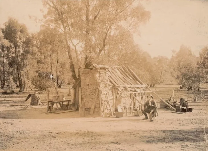
Known as Mongrel Point Huts or Tom’s Hut Aberfeldy.
Located: in the Baw Baw and Walhalla region. From Walhalla: Follow Walhalla Road north through Aberfeldy, then use the Mount Selma Road system to reach Fiddlers Green. Follow Fiddlers Green Road south-east towards Mongrel Point and the corrected position below. The forest roads are unsealed; use your map to choose a suitable parking point and walk the final approach if the spur is unsuitable for your vehicle.
History
Mongrel Point Huts, also known as Tom’s Hut, is associated with gold-mining activity around Aberfeldy. Mining in the district was particularly active from the 1850s through to the early 1900s, when prospectors and miners established workings, tracks and basic shelters through the surrounding bush.
The hut is a compact weatherboard and slab structure of the type commonly built by miners needing simple, temporary accommodation close to their workings. Its small scale and practical construction reflect the conditions and materials available in the area during the mining era.
The 2013 bushfires damaged the hut. No verified repair or rebuilding details are currently available.
Construction
Stone chimney and timber.
Maintained; Listed in VHCHA maintenance Region 4 (Baw Baw), on land managed by DEECA (formerly DELWP).
Mapping Guidance:
GPS (WGS84 assumed): 37.629070°S, 146.403970°E.
UTM: Zone 55, southern hemisphere (grid zone 55H), 447407 mE, 5835172 mN. Approximate position, retaining the corrected coordinates previously recorded on this profile.