
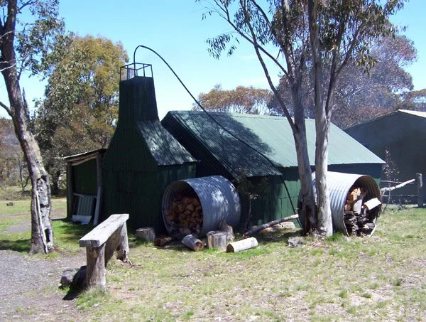
Higgins Hut
Photograph by Gary Duncan © November 2003.
Known as Mount Tamboritha Hut or Higgins Hut.
Located on the Bennison Plains near Mount Tamboritha, on privately controlled land used by Snowy River Horse Tours. From Licola take Tamboritha Road, staying on the eastern side of the Macalister River rather than crossing into the village. The operator’s directions place the signed hut turn-off about 38 km along this road, with the hut approximately 1 km down the private access track: about 39 km driving overall. The first approximately 22 km is sealed, followed by gravel. Arrange entry and parking with the operator; the access gate is controlled and casual public access should not be assumed.
History
The Higgins family’s account identifies the present building as the third hut. Michael Higgins senior built the original log-and-bark Mount Tamboritha Hut about 1880; the earlier published account gives about 1894, so this date remains disputed. It accidentally burnt down in 1923. Rex Miller built its replacement, which also burnt down in 1933. Jack and Mick Higgins built the present iron-and-log hut later that year. The operator continues to use it as the centre of its horse-riding operation.
Construction
Timber and iron construction with a gabled roof.
Cartakers Snowy River Horse Tours.
References
Stephenson, pp. 326, 327, 329;
Snowy River Horse Tours, About Us and Directions to Higgins Hut; ExplorOz/Bushtracker place record 53489.
Mapping Guidance
GPS: 37.45871°S, 146.72743°E.
UTM Zone 55H: 475894 m E, 5854205 m N. Approximate mapped position, treated as WGS84. A coordinate does not necessarily provide permission to enter the property.