
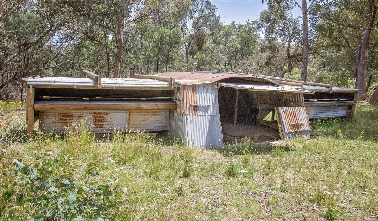
Flying Swagman Hut
Known As The Flying Swagman Hut or Mt Elliott Hut
Located: near Mount Elliot summit, east of Corryong.
From Corryong, take the road towards Khancoban, then the road towards Biggara and the signed Fishers Track gate. Follow Fishers Track uphill towards the tower and summit area. Towong Shire describes Mount Elliot as about 20 minutes from Corryong, with limited 2WD access on unsealed Fishers Track; check road conditions and gate arrangements locally.
Mount Elliot Ridge Track via Thowgla Road is the 4WD alternative. Leave gates as found. The exact parking-to-hut walking distance remains unverified.
History
John Fisher, locally known as the Flying Swagman, built this combined glider hangar and shelter in the mid-1960s. He cleared part of Mount Elliot to launch his ES 57 Kingfisher glider by bungee. The hangar had a curved iron centre with side extensions for the wings and a caravan behind it. Only part of the original structure survived before restoration by VHCHA volunteers. Source: Australian Gliding Museum Newsletter No. 44 (2023).
3D Imagery
The VHCA association has created a 3D image of this hut and many others, after restoration. It can be found here: https://my.matterport.com/show/?m=s28coCQbGfZ
Construction
This is an unusual hut in that the roof is made from curved corrugated iron from water tanks. The photo on left was taken post restoration. VHCHA volunteers have spent some years (2023 - 2026) restoring it to a magnificent state.
References;
Mapping Guidance;
GPS latitude/longitude: 36.183955°S, 147.978928°E.
UTM: Zone 55, southern hemisphere (grid zone 55H), 588024 mE, 5995204 mN. Approximate hut position from ExplorOz; datum not stated by the source.
