
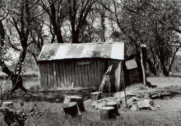
Commins Hut
Black-and-white photograph courtesy of Klaus Hueneke © 2002.
Known as Commins Hut.
Located on Nunniong Plains Track overlooking Quinn Plain. From Swifts Creek, follow the sealed Great Alpine Road north to Bindi Road, then take Bindi Road, Nunniong Road and Bentley Plains Road to Bentley Plain campground (about 38 km). Return along Bentley Plains Road to Nunniong Road and continue north, passing the Low Plains Track turn-off for Murphys Hut, to Nunniong Plains Track. Allow roughly 50 km driving via Bentley Plain to this junction. The forest roads are gravel; the final approximately 3 km to the hut is a rough 4WD track which can be deeply rutted and wet. Park clear of the junction and walk about 3 km one way, or continue by suitable 4WD only when the track is open and conditions permit.
History
VHCHA’s account, drawn from the Victorian Alpine Huts Heritage Survey (2005), dates this hut to about 1940 and attributes its construction to Bill Ah Chow for James (Jim) Commins and Charlie Duke.
Earlier accounts give other dates, including about 1948, so the precise year remains uncertain. The road to the hut was built in the 1960s. The hut survived earlier fires, but its present condition should be checked before visiting.
Construction
Wooden walls, with an iron roof and rickety furniture. Iron fireplace.
Caretakers - None
References
Hueneke, p. 234.
Mapping Guide
GPS: 37.13874°S, 147.94221°E — approximate (VHCHA map position; exact hut position unverified).