
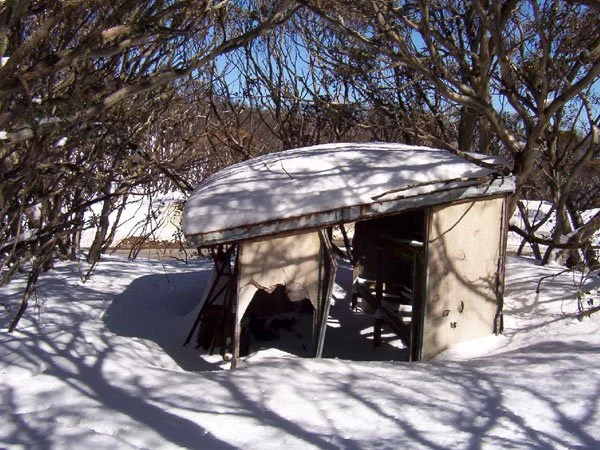
PMG Hut, Rene’s LO Hut
Photograph copyright Olaf Moon © 2003
Known as PMG Hut, Rene’s Lookout Hut
Located at above the Great Alpine Road near Rene’s Lookout, on the Harrietville approach to Mount Hotham, at about 1580 m.
From Harrietville follow the sealed Great Alpine Road uphill to the signed lookout locality between Mount Hope and Little Blowhard.
The earlier account places the hut about 40 m upslope from the road, with a short, potentially steep approach on foot. Exact road distance, a safe walking line and the hut’s survival in 2026 remain unconfirmed. Treat this as a historic site, not an available shelter, and do not enter an unstable structure.
History
The earlier account and photograph record a standing ruin near the road; its current condition is unknown. It was built about 1955 and used as a shelter for Post Master General's (Now Australia Post) linesmen working on the lines between Harrietville and Hotham.
Rene's lookout was named after Rene Bibby who was born Elizabeth Irene Bibby in 1895, the third daughter born to Thomas Michael Bibby and Elizabeth Mary McLean. Rene never married, was born in Harrietville and went to school there. Her nephew was William Thomas Bibby (Bill) married to Beverley Bibby. Bill is also related to the Howards and Dibbins as mentioned in other hut information pages on this site.
Ward Ambler Cabin "A" was located hereabouts also, but lost in the 1939 fires. Surprisingly this whole area was burnt during 2003, but for a little patch around this hut.
Construction
Typical of the time with a wooden floor, steel truss and cement panel boards for walls. The iron stove and chimney have rusted out. The hut would no doubt be in better condition if it was not above the snow line. Any repair proposal would require a current condition and heritage assessment.
Caretakers - none.
References
Magnussen Pp 59 - 60
Hueneke - no ref.
Beverley Bibby - pers comm.
Mapping Guidance;
Approximate historic-site GPS: 37.00215°S, 147.10017°E.
UTM Zone 55H: 508912 m E, 5904884 m N (WGS84).
Calculated from the former map grid GR088047 assuming AMG/AGD66 Zone 55; datum and exact hut position are unconfirmed. Use only as a broad locality, not a verified waypoint.